
Title:
Home Port
Description:
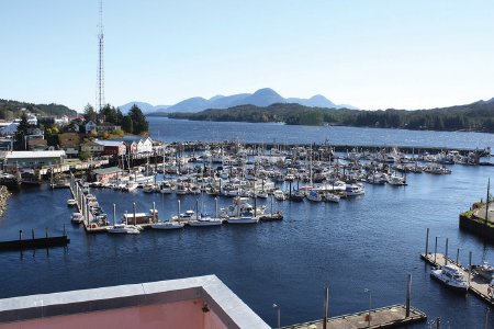
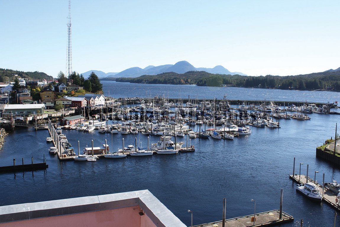
"This is an aerial photo taken of Thomas Basin from the top of the Federal Building. I love the subject of this photograph because it encompasses three locations that are near and dear to my family and our life in Ketchikan: Pennock Island, Tongass Narrows, and historic Thomas Basin. We have called Pennock our home for nearly ten years. This is the direction of Home. Our dock is visible in this photo. The growth on Pennock Island in the last 62 years is minimal. We travel two to four times a day back and forth across the Narrows. This is the mile of water that connects our remote seaside home to the buzzing social life of school and friends. Thomas Basin is where we have harbored our vessels for the last ten years. We park, have arguments, schlep groceries, celebrate victories, right here on the docks. Our business, ketch—i—kreatures! is located right here, the second peak to the left, historic Thomas Street, our home away from home. Thomas Basin is our neighborhood and the Tongass Narrows is our street. These are our neighbors. This is a beautiful perspective of Our Life."
— Katy Posey
Modern image
Photographer: Katy Posey
On loan courtesy of Katy Posey, L2015.4.81
Historic image
Thomas Basin from the top of the Federal Building, February 3, 1954 Photographer: Paulu T. Saari
Donor: Paulu T. Saari, KM 2003.2.63.231
— Katy Posey
Modern image
Photographer: Katy Posey
On loan courtesy of Katy Posey, L2015.4.81
Historic image
Thomas Basin from the top of the Federal Building, February 3, 1954 Photographer: Paulu T. Saari
Donor: Paulu T. Saari, KM 2003.2.63.231
Click to Enlarge
 Modern image by Katy Posey
 Historic image by Paulu T. Saari
 Modern image by Katy Posey
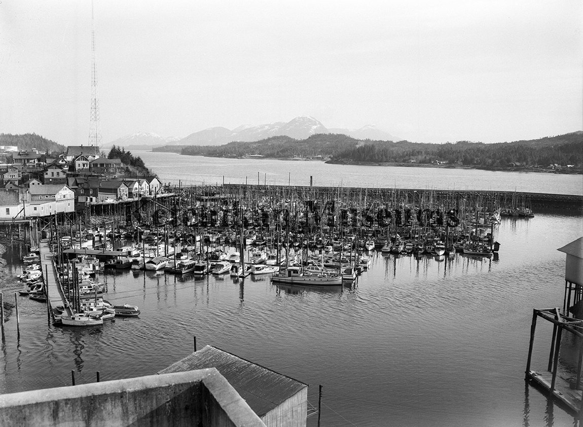 Historic image by Paulu T. Saari